

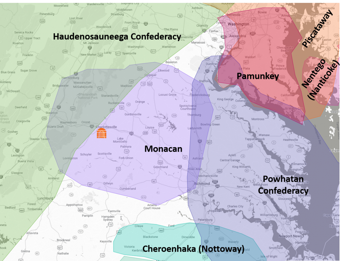
This map illustrates the traditional territory of the Monacan Indian Nation, which encompasses an area in Central Virginia extending east to just outside of Richmond, north to Culpepper, west to Staunton, and south to Dillwyn. The Pamunkey Indian Tribe, the Chickahominy, the Eastern Chickahominy, the Upper Mattaponi, the Rappahannock, and the Nansemond also call this home. Bordering this area to the east are the Pamunkey, Powhatan Confederacy, and the Cheroenhaka (Nottoway) tribes, and to the west the Haudenosuneega Confederacy.